dahon-k3時々いろいろな自転車

DAHON K3 で全国を輪行制覇したい。。。

DAHON K3 【サイクリング】姫路駅から室津、相生、赤穂を越えて日生駅 DAHON K3 [Cycling] From Himeji Station to Murotsu, Aioi, and Ako to Hinase Station

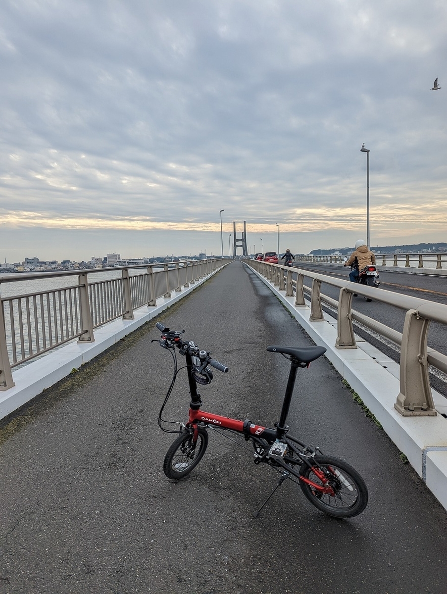
非常に長い距離とアップダウンのある海沿いの景色がいいルートです。姫路駅の南口を出発し、たつの市の道の駅御津を目指します。道の駅御津までは、地方の市街地を走るような風景が延々と続きます。道の駅御津からは、コンビニすらなくなるので補給食を忘れずに。

道の駅御津を越えると室津までは国道250号線の一本道です。室津の集落は古くからの瀬戸内海の集落で、趣がある場所ですので、ポタリングしましょう。室津を出ると、万葉岬が近いです。散策路の整備された万葉岬は家島や、小豆島など瀬戸内海東部を一望できます。

万葉岬を越えると、相生市街に入っていきます。道の駅相生があるので、休憩にはもってこいです。

相生から赤穂までは国道250号線をひたすら走ります。途中坂越の集落があるので、体力と時間がある人は寄ってみてください。また、兵庫県立赤穂海浜公園とかも寄り道にはいいところです。赤穂で戻る場合は、両方よれますが、日生まで行くと時間的に厳しくなるかもしれません。

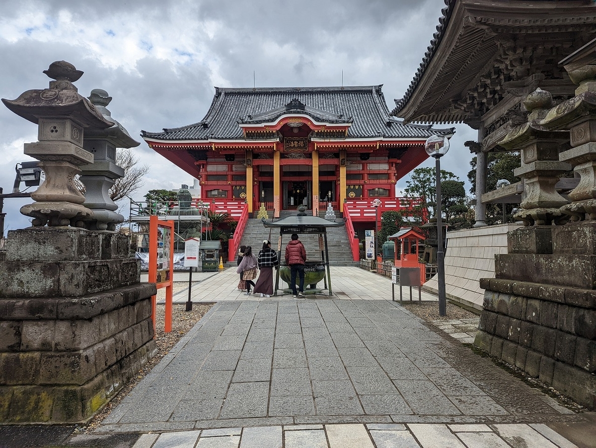
赤穂市街は、整備された赤穂城址や大石神社など、忠臣蔵関連の遺産がたくさんあります。

赤穂を離れ、再度国道250号線に戻り備前市の日生に向かいます。兵庫県岡山県の県境を越えるあたりは上り坂が続きます。日生エリアに入ると日生大橋を渡り鹿久居島へ、さらに頭島大橋を渡り頭島へ。鹿久居島の方が面積は大きいですが、人口は頭島の方が多いようですね。頭島で、たぬき山展望台に登ると、まさに絶景でした。帰りは再度橋を渡り、日生駅からの帰還です。

トータルで約75km、走行時間は5時間35分、経過時間は8時間15分でした。

After passing Cape Manyo, you will enter Aioi city. There is a roadside station Aioi, so it's perfect for a break.

From Aioi to Ako, run on Route 250. There is a village of Sakoshi on the way, so if you have physical strength and time, please stop by. Hyogo Prefectural Ako Seaside Park is also a good place to stop by. If you return from Ako, you can do both, but if you go to Hinase, it may be tight in terms of time.

The city of Ako has many heritage sites related to Chushingura, such as the well-maintained ruins of Ako Castle and Oishi Shrine.

Leaving Ako, return to Route 250 again and head for Hinase in Bizen City. The uphill continues around the border between Hyogo and Okayama prefectures. When you enter the Hinase area, cross the Hinase Ohashi Bridge to Kakui Island, and then cross the Kashirima Ohashi Bridge to Kashirima Island. Kakuijima has a larger area, but Kashirima has a larger population. When I climbed the Tanukiyama observatory on Kashirashima, it was just a superb view. On the way back, cross the bridge again and return from Hinase Station.

The total distance was about 75 km, the running time was 5 hours 35 minutes, and the elapsed time was 8 hours 15 minutes.


姫路駅から道の駅御津まで


道の駅御津から道の駅相生まで

赤穂市

赤穂市街から日生

インスタもよろしくお願いします。

After passing Cape Manyo, you will enter Aioi city. There is a roadside station Aioi, so it's perfect for a break. From Aioi to Ako, run on Route 250. There is a village of Sakoshi on the way, so if you have physical strength and time, please stop by. Hyogo Prefectural Ako Seaside Park is also a good place to stop by. If you return from Ako, you can do both, but if you go to Hinase, it may be tight in terms of time. The city of Ako has many heritage sites related to Chushingura, such as the well-maintained ruins of Ako Castle and Oishi Shrine. Leaving Ako, return to Route 250 again and head for Hinase in Bizen City. The uphill continues around the border between Hyogo and Okayama prefectures. When you enter the Hinase area, cross the Hinase Ohashi Bridge to Kakui Island, and then cross the Kashirima Ohashi Bridge to Kashirima Island. Kakuijima has a larger area, but Kashirima has a larger population. When I climbed the Tanukiyama observatory on Kashirashima, it was just a superb view. On the way back, cross the bridge again and return from Hinase Station. The total distance was about 75 km, the running time was 5 hours 35 minutes, and the elapsed time was 8 hours 15 minutes.


DAHON K3 【サイクリング】琵琶湖東岸南部を走る DAHON K3 [Cycling] Running along the southeastern coast of Lake Biwa

琵琶湖1周通称ビワイチといわれ、サイクリストの憧れのコースです。とはいえ、200㎞近い距離を1度で走るのはK3の走力と、冬の短い時間、琵琶湖北部の積雪などこの時期では厳しいので、電車も多く、天候も優しい南東部を走りました。

能登川駅から伊崎寺に向かい、そこから琵琶湖沿いを進み途中サイクリストの聖地を抜け、起点となる唐橋まで。帰りは、石山駅になります。トータルの距離は55㎞です。

It is a cyclist's longing course, commonly known as Biwaichi, which goes around Lake Biwa. However, running a distance of close to 200km in one go was difficult because of the power of the K3, the short winter hours, and the heavy snowfall in the northern part of Lake Biwa. .

From Notogawa Station, head for Izaki-dera Temple, then follow Lake Biwa and pass through a sacred place for cyclists on the way to Karahashi Bridge, which is the starting point. On the way back, it will be Ishiyama station. The total distance is 55km.

能登川の駅をスタートして、一路東へ。まずは、田園地帯を走る感じです。正面に比叡山の山々が見えます。途中、伊崎寺というお寺が琵琶湖に突き出るようにあって、面白そうなので寄っていました。伊崎寺は駐車場から1㎞ほど歩かねばならず、簡単なハイキングみたいな感じでした。伊崎寺を後にすると、琵琶湖沿岸を走る県道25号線沿いをひたすら南東に向かいます。長命寺の交差点までは、琵琶湖は見えますがどちらかというと山道が続きます。

Start at Notogawa Station and head straight east. First of all, it feels like running in the countryside. You can see the mountains of Mt. Hiei in front of you. On the way, there is a temple called Izaki-dera that sticks out into Lake Biwa, and it looked interesting, so I stopped by. Isakidera was a short hike, about 1km from the parking lot. After leaving Isakidera, head straight southeast along Prefectural Route 25, which runs along the coast of Lake Biwa. Until the intersection of Chomeiji, you can see Lake Biwa, but rather the mountain road continues.

長命寺の交差点を右折し、県道26号線へ。県道26号線を直進すると県道559号線に変わり、さざ波街道と呼ばれる道路へ。程なくすると、藤ヶ崎龍神社が見えてきます。ロードバイクの人が写真を撮っていましたし、結構車輪のわだちもあったので、自転車乗りに人気のスポットなのでしょう。藤ヶ崎龍神社を越えると、第2なぎさ公園までひたすら走ります。第2なぎさ公園はBIWAKOのモニュメントとサイクリストの聖地のモニュメントがあり、年末のオフシーズンでも自転車乗りがたくさんいました。

Turn right at the intersection of Chomeiji and take Prefectural Route 26. If you go straight on Prefectural Road 26, it will change to Prefectural Road 559 and you will reach the road called Ripples Highway. After a while, you will see Fujigasaki Ryu Shrine. Road bikers were taking pictures, and there were quite a few ruts on the wheels, so it must be a popular spot for cyclists. After passing Fujigasaki Ryu Shrine, I will run all the way to No. 2 Nagisa Park. The second Nagisa Park has a monument of BIWAKO and a monument of a sacred place for cyclists, and there were many cyclists even in the off-season at the end of the year.

サイクリストの聖地を越えると、すぐに琵琶湖大橋が見えてきます。今夏は琵琶湖大橋は渡らずに、ひたすら南下します。佐川美術館を越え、烏丸半島を走りました。烏丸半島からも琵琶湖沿いをひたすら走り、瀬田川が見えてくると唐橋まではすぐです。

インスタもよろしくお願いします、


DAHON K3 【サイクリング】佐鳴湖サイクリング DAHON K3 [Cycling] Lake Sanaru Cycling

浜松駅から浜松城を経由し、佐鳴湖を4分の3ほど回り高塚駅へ。12㎞の道のりでした。青春18きっぷで午前沼津富士を走ったので夕方から走ったので、時間の都合上短い距離になりました。このエリアでは浜名湖1周のハマイチが有名ですが、まずは小さい佐鳴湖から攻めました。

From Hamamatsu Station, go through Hamamatsu Castle and go around Lake Sanaru about three quarters to Takatsuka Station. It was a 12km drive. I ran Numazu Fuji in the morning with the Seishun 18 Kippu, so I ran in the evening, so the distance was short due to time constraints. This area is famous for the Hamachi around Lake Hamana, but we started by attacking Lake Sanaru, which is small.


DAHON K3 【サイクリング】沼津から富士防潮堤サイクリング DAHON K3 [Cycling] Cycling from Numazu to Fuji Seawall

沼津駅から駿河湾に向かい、防潮堤の上を走るルート。田子の浦の富士と港の見える公園の近くまでほぼ直線かつ、広々とした道を走ります。基本的に交差点以外は一般車はいないので、楽しく走れます。富士と港の見える公園から少し富士市内を走り、富知六所浅間神社により、富士駅から輪行でした。距離はおよそ27㎞です。

A route that runs over the seawall from Numazu Station to Suruga Bay. It runs on an almost straight and wide road until near the park where you can see Tagonoura Mt.Fuji and the port. There are basically no general cars except for intersections, so you can enjoy driving. From the park where you can see Mt.Fuji and the port, I ran a little bit in Fuji city and went to Tomichi Rokusho Sengen Shrine, and it was a bicycle from Fuji station. The distance is approximately 27 km.

沼津駅から駿河湾へ向かいます。防潮堤は結構上れるところが限られるのでご注意を。

防潮堤に登ると左手には駿河湾、右手には松林が見えます。風がなければすごく気持ちがいいです。また、富士山もところどころ見ることができます。

走路は防潮堤の上、防潮堤沿いの海側のどちらでも大丈夫です。

Head to Suruga Bay from Numazu Station. Please note that the seawall is quite limited in places that can be climbed.

When you climb the seawall, you can see Suruga Bay on your left and a pine forest on your right. It feels great when there is no wind. You can also see Mt.Fuji here and there.

The course can be on the seawall or along the seawall.


富士と港の見える公園には、ストゥーパらしきものが。。。

ここから、富知六所浅間神社に寄り、富士駅に向かいました。浅間神社は富士山とかかわりの深い神社なので、このエリアではできる限り回りたいものです。

In the park where you can see Mt. Fuji and the harbor, there is something like a stupa. . .

From here, I stopped by Tochi Rokusho Sengen Shrine and headed for Fuji Station. Sengen Shrine is a shrine that has a deep connection with Mt. Fuji, so I want to visit as much as possible in this area.


番外編 枕崎市でレンタルサイクル Extra: Rental bicycles in Makurazaki City

枕崎市でレンタルレンタルした時(2020年8月)のレポートです。現在もレンタルサイクルをやっているかはウェブサイトでご確認をしてください。

コースとしては、枕崎駅前から火の神公園を経由して坊津まで行き、帰りに薩摩酒造によって焼酎の藏の見学をしました。距離はおよそ25㎞です。

This is a report when I rented a car in Makurazaki City. Please check the website to see if they are still renting bicycles.

As a course, we went from Makurazaki Station to Bonotsu via Hinokami Park, and on the way back, we visited the shochu storehouse of Satsuma Sake Brewery. The distance is approximately 25km.


かなりアップダウンの激しい道ですが、電動アシスト者を借りられるのでぐんぐん登っていきます。景色はそれなりにいいので、ゆっくりと走りたいものです。

It's a road with a lot of ups and downs, but you can borrow an electric assist person, so you can climb steadily. The scenery is pretty good, so I want to run slowly.


枕崎市と、南さつま市の坊津への道は峠を一つ越える感じです。坊津エリアは南さつま市でも枕崎市に近く結びつきが近い感じがしたのは漁業が盛んだからでしょうか。

The road to Bonotsu in Makurazaki City and Minamisatsuma City crosses a mountain pass. The Bonotsu area is close to Makurazaki city, even in Minamisatsuma city.

帰りは、薩摩酒造を見学して終了です。

On the way back, visit the Satsuma Sake Brewery and finish.


DAHON K3 【サイクリング】銚子駅から鎌数伊勢大神宮 DAHON K3 [Cycling] From Choshi Station to Kamakazu Ise Grand Shrine

漁業の町、初日の出が早い町、利根川の河口、醬油のまち、銚子電鉄などなど、銚子市の持つイメージは人それぞれたくさんあります。海あり、川あり、歴史ありの観光資源に恵まれた銚子市はサイクリングをするにはもってこい。駅にもレンタルサイクルはありますが、売り切れでした。さすが人気の町ですね。銚子駅から銚子大橋を渡り、茨城県へまず入ります。大きな橋を渡り越県するのはいつもワクワクするものです。神栖市側で利根川の河口まで行き、再度銚子市に戻ります。銚子電鉄観音駅もできるようなお寺である圓福寺により、銚子ポートタワー方面へ。ポートタワーからは海岸線沿いに南下し、犬吠埼を目指します。犬吠埼からも海岸線・ジオパークを巡り飯岡刑部岬へ。最後に、鎌数伊勢大神宮により、干潟駅からの戻りになります。トータルは55㎞、ややアップダウンのあるコースです。

People have many images of Choshi City, such as a fishing town, a town where the first sunrise of the year comes early, the mouth of the Tone River, a town of soy sauce, Choshi Electric Railway, and so on. Choshi City, which has the sea, rivers, and historical tourism resources, is perfect for cycling. There is a rental cycle at the station, but it was sold out. It's a popular town. From Choshi Station, cross the Choshi Ohashi Bridge and enter Ibaraki Prefecture. Crossing a big bridge to Yue County is always exciting. On the Kamisu City side, go to the mouth of the Tone River and return to Choshi City. Head towards Choshi Port Tower from Enpukuji, a temple that can also be used at Choshi Electric Railway Kannon Station. From Port Tower, head south along the coastline toward Inubosaki. From Inubosaki, you can also go around the coastline and geopark to Cape Iioka Gyobu. Finally, Kamakazu Ise Daijingu will take you back from Higata Station. The total length is 55km, and the course has some ups and downs.

まずは、銚子駅を出て銚子大橋を渡り茨城県側を目指します。銚子駅付近はきれいに整備されており、観光案内所ではレンタルサイクルもやっております。また、自転車を電車に乗せられるBBベースというのもやっておりますので、気になる方はJRに確認を。

銚子駅を出て、利根川に向かい、銚子大橋へ。歩道と車道が分離している大きな橋で、景色がとても楽しめます。茨城県側には特に何かあるわけではありませんが、銚子市街が利根川越しによく見えました。

First, leave Choshi Station and cross the Choshi Ohashi Bridge and aim for the Ibaraki Prefecture side. The area around Choshi Station is well maintained, and you can rent bicycles at the tourist information center. We also have a BB base that allows you to ride a bicycle on the train, so if you are interested, please check with JR.

Leave Choshi Station, head for the Tone River, and head for Choshi Ohashi Bridge. It is a large bridge where the sidewalk and the roadway are separated, and you can enjoy the scenery very much. There is nothing in particular on the Ibaraki Prefecture side, but I could see the city of Choshi well over the Tone River.

銚子市に再度戻り、飯沼観音の名前で知られる圓福寺へ。この辺りでは、群を抜いて大きなお寺になります。飯沼観音から、ポートタワーを経由し、犬吠埼を目指します。ポートタワーまでは意外とアップダウンのある道で、道も細いところがあり、あまり快適ではありません。海岸線に出ると、風が強く、向かい風が吹くときついかもしれません。犬吠埼は、観光名所ということもあり、多くの人がおりました。

Return to Choshi City and visit Enpukuji Temple, known by the name of Iinuma Kannon. In this area, it will be a big temple by far. From Iinuma Kannon, go to Inubozaki via Port Tower. The road to Port Tower is unexpectedly up and down, and the road is narrow in places, so it is not very comfortable. When you go out to the coastline, the wind is strong and it may be tough when the headwind blows. Inubosaki is a tourist attraction, so there were many people.

犬吠埼から、飯岡刑部岬展望台までもできるだけ海岸線を走りたいところですが、意外と海は見えずという感じです。途中のイオンモールが大きくて、なんか地方あるあるな感じです。飯岡刑部岬からの展望を楽しんだ後は、少し距離はありますが、鎌数伊勢大神宮へ。猫がいたのが印象的。鎌数大神宮から干潟駅はすぐです。この辺りは昔海だったのかしらと思いつつ電車に乗りました。

From Inubosaki to Iioka Gyobu Misaki Observatory, I would like to run along the coastline as much as possible, but I can't seem to see the sea. The AEON MALL on the way is big, and it feels like there is something in the countryside. After enjoying the view from Cape Iioka Gyobu, it's a bit far, but head to Kamakazu Ise Grand Shrine. It was impressive that there was a cat. Higata Station is very close to Kamakazu Daijingu. I got on the train wondering if this area used to be the sea.

インスタもよろしくお願いします。


DAHON K3 【サイクリング】小山~結城~下野 小さな城下町と寺社巡り DAHON K3 [Cycling] Oyama - Yuki - Shimotsuke Small castle town and temples and shrines tour

栃木県南部の鉄道交通の要所である小山市から茨城県結城市に入り、下野市から帰るルートです。小山というと私には小山遊園地がイメージにありますが、遊園地があったのも今は昔。今では、宇都宮線東北新幹線水戸線両毛線の走る栃木県南部の交通の要衝として発展している町です。古くには、日光街道が走り、お城もあった城下町です。まずは、間々田地区にある間々田八幡宮へ。この辺りでは大きな神社で、敷地にある池と紅葉が素晴らしかったです。間々田八幡宮を後にすると北上して、市街地に入ります。須賀神社により、小山城址に寄った後結城に向かいます。ほぼ平坦の40㎞弱の道のりです。

It is a route that enters Yuki City in Ibaraki Prefecture from Oyama City, which is an important railroad transportation point in the southern part of Tochigi Prefecture, and returns from Shimotsuke City. When I think of Oyama, I have an image of Oyama amusement park, but it's been a long time since there was an amusement park. Today, the Utsunomiya Line, the Tohoku Shinkansen, the Mito Line, and the Ryomo Line run through this town, which has developed as a transportation hub in the southern part of Tochigi Prefecture. In the olden days, the Nikko Highway ran through this castle town, and there was even a castle. First, head to Mamata Hachimangu Shrine in the Mamata area. This is a big shrine around here, and the pond and autumn leaves on the site were wonderful. After Mamada Hachimangu Shrine, head north and enter the city. After visiting Oyama Castle Ruins by Suga Shrine, head to Yuki.

小山市から西に向かい結城市へ。結城といえば結城紬で有名です。健田須賀神社にお参りをした後、紬の里に寄り、結城城址へ。城跡といっても、何か残っているわけではなく、小高い丘の公園という感じでした。

Head west from Oyama City to Yuki City. Yuki is famous for Yuki Tsumugi. After visiting Takedasuga Shrine, stop by Tsumugi no Sato and visit the ruins of Yuki Castle. Even though it was a castle ruin, nothing remained, and it felt like a park on a small hill.

結城市を北上し、再び栃木県に入ります。料理の神様を祀っている高椅神社にお参りをし、近くにあった鯉・恋ロードで写真をパチリ。その後、風土記がおかまで走り、帰りは小金井駅からのバックです。

Go north from Yuki City and enter Tochigi Prefecture again. We visited Takai Shrine, which enshrines the god of cooking, and took pictures at the nearby Koi/Koi Road. After that, Fudoki runs to Oka, and the return is back from Koganei Station.

インスタもよろしくお願いします。